


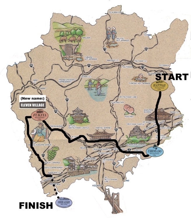
As there’s arguably much more to do in Fukiya and Shiraishi than in Hattoji and Ushimado, this route assumes that you’ll want to go there last and extend your stay in those two places at least. (If you have the time, of course, by all means spend two nights at each villa to give yourself a full day in each place to relax and get to know the area.) That means the real decision is where to start from: Ushimado or Hattoji. Since Hattoji is right near the border with Hyogo Prefecture and probably easier to get to, our default assumption is that you’ll find it most convenient to start from there. The most direct route from Ushimado across the prefecture to Fukiya in the west passes directly through Okayama City. Normally we try to avoid routes through major urban areas, but in this case we make an exception to take advantage of the lovely 20km bikepath along a small river just north of Okayama. Also, passing through Okayama makes it possible to stop there for the night if you want to break up that one long ride (there are plenty of low-cost accommodation options in the city center).
You can pick up the bikepath (Kibji Jitenshado) just northwest of Okayama Station, at either the Bizen Ichinomiya railway station or at nearby Kibitsuhiko Shrine. The most direct way to get there is to head west from Okayama Station and turn right (north) on small Route 61; that will lead you to the shrine and then the station in that order. The bikepath ends at Soja Station; from there it’s a short distance to the Takahashi River that you can cycle along until just below the city of Takahashi. At that point, you turn left and cycle along the Nariwa River until you reach Nariwa-cho, then head up into the mountains on Route 300 and turn onto tiny Route 85 which leads to Fukiya.
In the future, we’ll add as another option the route that goes to Ushimado first and then Hattoji; in that case, the route from Hattoji to Fukiya will be one farther north that bypasses central Okayama City.
Bikepath references:
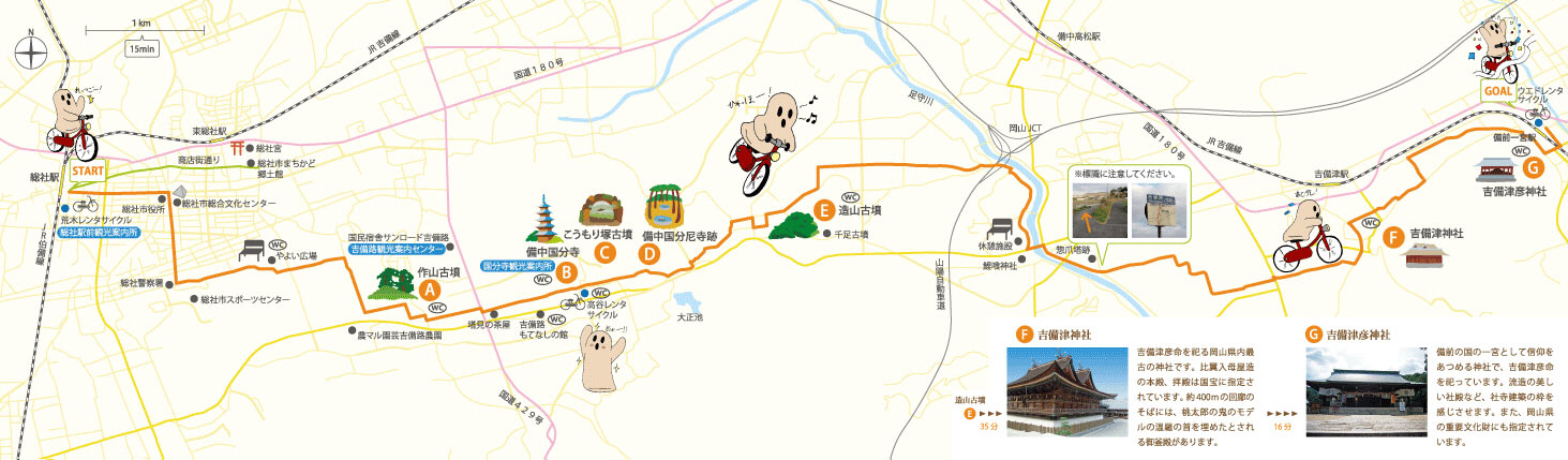
A map in Japanese showing the route of the bikepath is here: http://www.city.soja.okayama.jp/data/open/cnt/3/5904/1/map_2.jpg
A page (also in Japanese) with detailed information and photos along the bikepath is here:
http://cycle-guide.panasonic.jp/special/yamahon/85.do
The map at the bottom of this page has two advantages over the map above. For one thing, it can be expanded using the sliding scale bar to show you the route in very great detail. For another thing, it also has a suggested route for the short section leading from Okayama Station to the Bizen Ichinomiya Station / Kibitsuhiko Shrine area where you can join the bikepath.
(Note: Ushimado is no longer a prefectural International Villa, but the name in English seems to be unchanged, and the villa itself still bears the original logo at the front entrance, so that logo is used in the map below.)


