MAPhttp://www.kancycling.com/KANcycling/Map.htmlhttp://www.kancycling.com/KANcycling/Map.htmlshapeimage_8_link_0

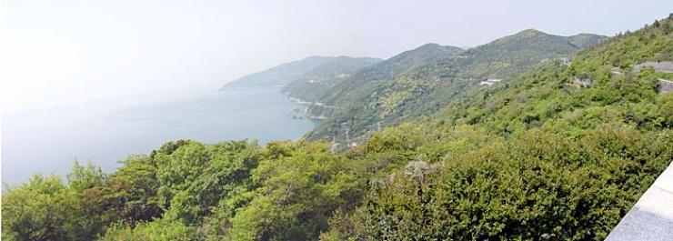
Here is a fairly typical panoramic view from the ridge road, with the road (just below the ridge) visible in the distance, along with another road closer to sea level.

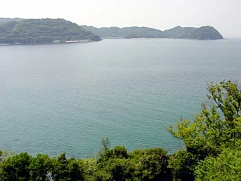
At times the “ridge” road also drops down almost to water level.

Alternatives../Hokkaido_Okhotsk/Hokkaido_Okhotsk_Alternatives.html../Hokkaido_Okhotsk/Hokkaido_Okhotsk_Alternatives.htmlshapeimage_13_link_0
Story & PhotosSadamisaki_Story_%26_Photos.htmlSadamisaki_Story_%26_Photos.htmlshapeimage_14_link_0
Nuts & BoltsSadamisaki_Nuts_%26_Bolts.htmlSadamisaki_Nuts_%26_Bolts.htmlshapeimage_15_link_0
AlternativesSadamisaki_Alternatives.htmlSadamisaki_Alternatives.htmlshapeimage_16_link_0
RouteSadamisaki_Route.htmlSadamisaki_Route.htmlshapeimage_17_link_0
SADAMISAKISadamisaki.htmlSadamisaki.htmlshapeimage_18_link_0