MAPhttp://www.kancycling.com/KANcycling/Map.htmlhttp://www.kancycling.com/KANcycling/Map.htmlshapeimage_8_link_0


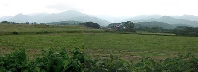
This area featured some of the prettiest terrain I saw on the entire trip, a mix of rolling hills and mountains. As I recall, this was somewhere between Otoineppu and Nakatonbetsu.

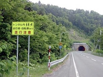
Credit where credit is due: this is the first time anywhere in Japan that I’ve seen a sign like this at a tunnel entrance, warning drivers to look out for pedestrians or bicyclists who might be inside. From here, it’s less than 20 km to Lake Kutcharo and the end of the day’s journey.

Story & PhotosHokkaido_Okhotsk_Story_%26_Photos_1.htmlHokkaido_Okhotsk_Story_%26_Photos_1.htmlshapeimage_13_link_0
Nuts & BoltsHokkaido_Okhotsk_Nuts_%26_Bolts.htmlHokkaido_Okhotsk_Nuts_%26_Bolts.htmlshapeimage_14_link_0
AlternativesHokkaido_Okhotsk_Alternatives.htmlHokkaido_Okhotsk_Alternatives.htmlshapeimage_15_link_0
RouteHokkaido_Okhotsk_Route.htmlHokkaido_Okhotsk_Route.htmlshapeimage_16_link_0
HOKKAIDO OKHOTSKHokkaido_Okhotsk.htmlHokkaido_Okhotsk.htmlshapeimage_17_link_0