


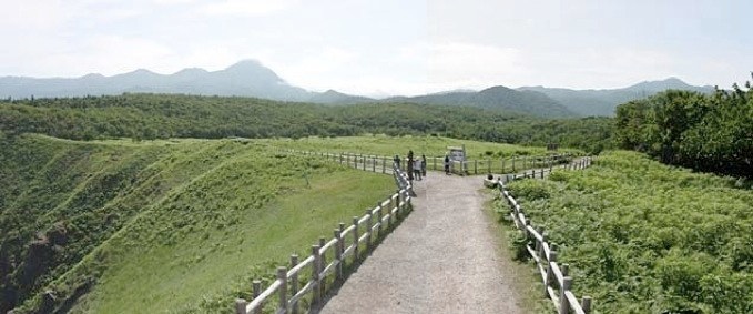
On my previous visit, I took a patchwork quilt photo of a massive (and magnificent) cliff face that you can see here. The photo above shows what you can see if you look back up the trail from that cliff. As you can see, it was still a glorious day... no trace of fog whatsoever.
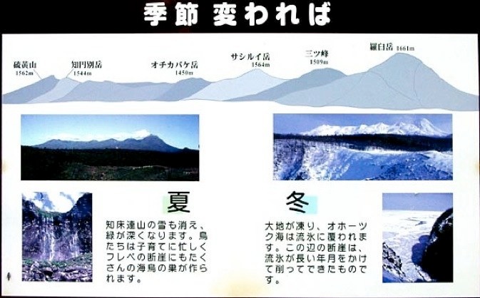
This is another of the great signs in Shiretoko, showing how different the area is in summer and winter, as well as the names and elevations of the peaks (Rausu, at 1661 m, is the winner, but they’re all pretty close - it’s no wonder that most of the people who come to Shiretoko are here to hike). Note the photo at lower right, showing that same massive cliff in winter with the sea frozen solid.